Tuesday, March 31, 2009

Michigan's White Garden with Moose


Michigan's White Garden with Moose


This true story starts with an email I forwarded, Monday, February 9th, 2009, 4:35 a.m., to selected people in my address book. The theme of this email
was regarding animals across America being born white in pigmentation
color. The spiritual meaning of this email was to share the sign of America's
white assortment of animals, being born. Review this web link, to watch
a special video called, 'Return of White' :

http://www.youtube.com/watch?v=CrdDoSM9r2M


This sign of the white animals is related to the theme, 'Our Creator is
Creating His New Garden' . . .


The email of 2-9-2009, was titled, 'Miracle White Buffalo born 1994, my message 1995 Pipestone'. I decided to send this email as a memorial
concerning my message August 13th, 1995, of Pipestone, Minnesota. This
message was related to the red blood rock (pipestone) and the white
buffalo prophecy of the Hopi. A white buffalo calf was born in 1994. This
birth was a `sentinel` regarding the last leg of the buffalo, as a symbolic
last dispensation, of the end times and/or final ages of earth as we know it.

Research :

http://pipestoneamerindiansfromisrael.blogspot.com/

()Pipestone Amerindians from Israel
()Seven Fires Ojibwa Wormwood Revelation
()Menorah Michigan Petroglyphs
()Symbolic Pipestone Meaning
()Is`Thomas clan`, related to: Thom Samuel Jones ?


`````````````````````````````````
3/9/2009 5:51:43 P.M.
`````````````````````````````````

I received an email from a Mr. King in California. Mr. King was sharing
a set of photographs about 2 albino moose. I neglected to read the caption
details of this email, which would have included the location of these
photographs taken.

```````````````
3/25/2009
```````````````

. . . 14 days after Mr. King emailed the 2 albino moose photographs, I
experienced the following set of spiritual messages . . .


Page 2

```````````````````````````````````````````````````````````````````````
The night ( after 08:00 p.m. ), of March 23rd, 2009
```````````````````````````````````````````````````````````````````````

I received a spiritual message about a man who had recently moved
from MICHIGAN. Mr. Helps is a Christian husband and father, seeking
enlightenment from his Biblical interest. I shared a paper with Mr. Helps,
which described the miles he had given me, between MICHIGAN and
Georgia, as 713.23. The 713.23 miles were a code about Biblical
chapters and verses. The message I was given for Mr. Helps was based
on the books : Joshua, Jeremiah, Judges : [ 7th chapter, 13th-23rd verses ]
of each book. And Joshua 7:20, reflected the hidden 'silver', which is the
main theme related to the Joash Bethel Stone of Benjamin's, silver cup.


````````````````````````````````````````````````````````
RESEARCH:

http://benjaminthecupsceptreofchrist.blogspot.com/

````````````````````````````````````````````````````````


Mr. Helps and I departed.

Two days later, . . .

`````````````````````````````````````````
Wednesday, March 25, 2009 10:55 AM
`````````````````````````````````````````

. . . I was given another spiritual message related to the 13 original colonies in America.
I saw a vision of the medical da Vinci man, with out stretched arms and legs being
presented, with the man laying on a map of America. I was shown the feet of this man
placed toward New York, the east, the placement of the 13 original colonies are all
east geography. The da Vinci man's head was placed facing up at California, the west.
It was required of me to understand burial placement of a Christian's head placed in
the west, so they rise at Judgment to meet Messiah in the Eastern sky.

The map of America represented a grave, with the da Vinci man's anatomy of body part's representing geographic locations of the State's, in America.

I knew upon completing this vision about the 13 original colonies of America, that
`MICHIGAN` was the da Vinci man's left thigh. The thigh symbolic wise caught my attention.

Then I reviewed my dream of the Severed Dragon, about the application of the anatomy
of the thigh being the femur, an encoded message about our government's organization
called, FEMA [ Federal Emergency Management Agency ].


`````````````````````````````````````````````````````````````````````````````````

http://dreamsvisionsmessages.blogspot.com/2009/02/pending-dream-input_2353.html
Monday, March 9th, 2009
DREAM:Severed female body parts (dragon)

`````````````````````````````````````````````````````````````````````````````````


Wednesday, March 25, 2009 10:55 AM
I emailed the 13 original colonies of America vision, to selected people.

This can be viewed at the new blog dated : March 31, 2009 :


Click here: Michigan's White Garden with Moose
http://michiganswhitegardenwithmoose.blogspot.com/


Page 3

````````````````````````
3/25/2009 1:04:01 P.M.
````````````````````````

. . . a lady named Mrs. Signal, from California, emailed her commentary
about the 13 original colonies of America, that I had sent :


--------------------------------------------------------------------------------
From: Mrs. Signal
To: bclarkgemetria@aol.com
Sent: 3/25/2009 1:04:01 P.M. Eastern Daylight Time
Subj: RE: : Human anatomy : 13 American Colonies `Feet` Beginnings


Well, sister, I know that this is off topic so to speak
but it is in the spirit...love you.

MICHIGAN just came to mind?

Shalom

Within the hour, . . . from Mrs. Signal's mention of MICHIGAN,
Mr. King re-sends the 2 albino Moose photograph's, from
March 9th, 2009, email.


--------------------------------------------------------------------------------
From: Mr. King
To: Bclarkgemetria@aol.com
Sent: 3/25/2009 1:59:59 P.M. Eastern Daylight Time
Subj: Fw: Albino Moose


Some more white critter creature pictures for you and your native American source.
I don't know the original source for these (e.g., Minnesota or MICHIGAN, ...)


I finally read the caption on Mr. King's photograph's of
the 2 albino moose and discovered that the 2 albino
moose were photographed in MICHIGAN.

So I start thinking at this point, how odd for Mr. King
14 days later, to re-send the same 2 albino moose
photographs today, March 25th, 2009 ?

I reflect upon, 2 days previous, on 3-23-09, the MICHIGAN
miles to Georgia message for Mr. Helps. It seemed some
type of spiritual chain of events were unfolding, between
people who do not know one another. They all know me,
not each other.


--------------------------------------------------------------------------------
From: Mr. King
To: Bclarkgemetria@aol.com
Sent: 3/25/2009 1:59:59 P.M. Eastern Daylight Time
Subj: Fw: Albino Moose


Not one, but two ! Truly amazing ! These animals were photographed just north of the Wisconsin border on a highway near Marenisco , MI . [MICHIGAN]

Once in awhile there is an opportunity to take in a piece of nature that you may never see. In these days of unrest and turmoil it is great to see that Mother Nature can still produce some wondrous beauty.


Page 4


--------------------------------------------------------------------------------
From: Mr. King
To: Bclarkgemetria@aol.com
Sent: 3/25/2009 1:59:59 P.M. Eastern Daylight Time
Subj: Fw: Albino Moose


The odds of seeing an albino moose are astronomical and to see this in the upper peninsula of MICHIGAN, near Wisconsin, is even greater than astronomical. To see two of them together is nearly impossible.

We wanted to share these photos with as many people as possible because you will probably never have a chance to see this rare sight again.

``````````````````````````````````````````````````````````````````````````````````````````````````````````````````````````````````````````````
RESEARCH : [ web link, to view 2 albino moose photographs which
have the above descriptions contained, within Mr. King's emails ]

http://www.snopes.com/photos/animals/albinomoose.asp

``````````````````````````````````````````````````````````````````````````````````````````````````````````````````````````````````````````````


Next, I emailed a researcher regarding FEMA/femur/thigh, being a
symbolic reference to MICHIGAN. Mrs. Ingrity reminded me about
her dream, regarding these items :

() the bear

() the number 94

() the name : William Paterson


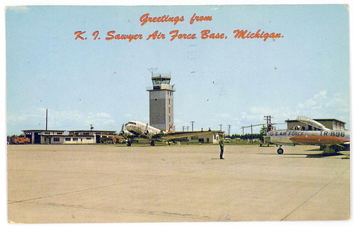
And Mrs. Ingrity, asked me if the 94 could be related to Sawyer Air Force Base [AFB], in MICHIGAN ?

Previous, I had forwarded to Mrs. Ingrity information about this
closed AFB.

And upon researching the 94, highway 94 is associated with
this closed AFB :

excerpt:
http://en.wikipedia.org/wiki/M-94_(Michigan_highway)
M-94 is a state trunkline in the Upper Peninsula of the U.S. state of Michigan It runs for 89.156 miles (143.483 km) from K. I. Sawyer to Manistique. The highway is part of the Lake Superior Circle Tour during a concurrency with M-28. M-94 crosses the Siphon Bridge in Manistique, unique for the fact that the bridge roadway is below water level.

M-94 has been realigned several times. It has had its own roadway between the M-28 junctions in Munising and Shingleton. Other changes have flip-flopped M-94 with M-28 between Harvey and Munising and extended it across the former K.I. Sawyer Air Force Base.


The bear, is related to the official state animal, the California grizzly bear.
Both Mr. King and Mrs. Signal, are connected to California. They
do not know each other, although they participated one hour apart,
in pointing my nose toward MICHIGAN.

And the da Vinic man's anatomy of the `head` in the vision of the 13 original colonies, was in California (west).

In Hebrew, the head means Resh/Rosh, the bear.


Mrs. Ingrity's ending of her dream, included the name William
Paterson. This is how the archetypal application of `Paterson`,
may be related to 2009, as a parallel to FEMA Camps, associated
with closed military bases, appointed on stand by, in case of
Marshal Law :

From: Bclarkgemetria@aol.com
Subject: Paterson, indeed parallels THE internment/FEMA CAMPS/COFFINS
To: Mrs. Ingrity
Date: Thursday, March 26, 2009, 9:55 AM


So, if Paterson is the ending of the dream, [7-30-2008], of the highway
94, east-west connection of MICHIGAN closed AFB, Sawyer.

And if the militia sent out by the President Washington, ended
in Paterson extolled the primacy of law over governments, does
that mean the same will happen in 2009-2010 ?

--------------------------------------------------------------------------------
From: Mrs. Ingrity
To: Bclarkgemetria@aol.com
Sent: 3/26/2009 9:42:14 A.M. Eastern Daylight Time
Subj: Re: Confirming you had clue `Michigan` since the dream 7-30-2008/topic `94`


He resigned the governorship to become an associate justice of the Supreme Court (1793-1806). There he presided over the trials of individuals indicted for treason in the Whiskey Rebellion, a revolt by farmers in western Pennsylvania over the federal excise tax on whiskey, the principal product of their cash crop. Militia sent out by President Washington successfully quelled the uprising, and for the first time the courts had to interpret the provisions of the Constitution in regard to the use of troops in civil disturbances. Here, and in fact throughout his long career, Paterson extolled the primacy of law over governments, a principle embodied in the Constitution he helped write.


Page 5

`````````````````````````
CONCLUSION :
`````````````````````````

In conclusion, the sighting of the 2 albino moose at this thigh/femur/FEMA
location in MICHIGAN, represents a type of a white buffalo calf sign. The
highway 94, related to the dream of Mrs. Ingrity's, may be a parallel to
the birth of the white buffalo calf, in 1994. The 2 albino moose were
photographed in 2006.

When God [IHVH], puts something in your heart, about your community,
He will confirm it with 2-3 witnesses. Indeed, MICHIGAN is being
confirmed with four witnesses. The vision of the severed map of America,
requires Christians to join together in prayer, regardless if these
Christians are strangers to one another. The following research links
will provide additional information about the severing of America.

As you discern from the title of this story, 'Michigan's White Garden
with Moose', is a sign of a renewal promised.

And this renewal will one day delete war, economic crisis, hunger
and strife removed, from the Creator's New Garden. In between time,
let us not keep our `head`, in the sand.


Revelation 21:1

And I saw a new heaven and a new earth: for the first heaven and the first earth were
passed away; and there was no more sea.


````````````````````````````````
Additional Research :
````````````````````````````````


http://michiganswhitegardenwithmoose.blogspot.com/
Blog Archive
▼ 2009 (12)
▼ March (12)

()Michigan's White Garden with Moose
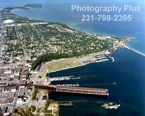
()Michigan [Marquette/Marenisco]
()Sawyer Air Force Base
()St. Lawrence Seaway
()America [severed map]
()FEMA [femur/thigh]
()13 Original Colonies of America
()WHITE ANIMALS
()50 Facts About U.S. Nuclear Weapons
()ARKHAVEN MINISTRIES MAPS PROTECTED AREAS
()MAP:Russian Scholar Says US Will Collapse
()SURVEILLANCE TOWERS IN MICHIGAN

Michigan [Marquette/Marenisco]


Michigan [Marquette/Marenisco]


http://web03.bestplaces.net/city/Marquette_MI.gif


http://www.photography-plus.com/images/Marquette/Marquette.jpg


``````````````````````````````````````````````````````````````````````
4 Risk Areas Near Air Force bases - . . . Marquette, Michigan . . .
``````````````````````````````````````````````````````````````````````


Most of the instructions are intended to be distributed during an escalating crisis, but in four risk areas near Air Force bases–Plattsburgh, New York; Limestone, Maine; Austin, Texas; and Marquette, Michigan–FEMA has recently taken out multi-page ads in the phone books.


Michigan [Marquette/Marenisco]
http://michiganswhitegardenwithmoose.blogspot.com/2009/03/michigan-marquettemarenisco.html


Sawyer Air Force Base
http://michiganswhitegardenwithmoose.blogspot.com/2009/03/sawyer-air-force-base.html
EXCERPT
http://en.wikipedia.org/wiki/K.I._Sawyer_AFB

K. I. Sawyer Air Force Base is a decommissioned U.S. Air Force base in
Marquette County, Michigan, south of the city of Marquette. The base, near the
center of Michigan's Upper Peninsula, closed in 1995. The county airport,
Sawyer International, now occupies a portion of the base and has scheduled
airline flights and some general aviation activity.


EXCERPT
http://www.aliciapatterson.org/APF0501/Zuckerman/Zuckerman.html

Crisis Relocation Planning


Evacuation

America’s major civil defense program is a slowly-developing plan to evacuate the residents of some 400 "high-risk" areas–major cities and the areas around key military and economic installations–to nearby small towns in an extreme international crisis. If, for example, the American and Russian troops whose face-off led to the stepped-up distribution of civil defense information proceeded to lob tactical nuclear weapons at each other, and American reconnaissance revealed that the Soviet Union had begun to evacuate its cities, then the American President would have the option of ordering a counter-evacuation. If a major nuclear attack on the United States then followed, FEMA asserts, 80 percent of the American population would survive, as opposed to the 40 percent that would survive, according to FEMA, if there were no evacuation.

As of 1981, actual evacuation plans had been drawn up for about 100, mostly smaller, high-risk areas, and those plans included ways of providing evacuation instructions to area residents. Most of the instructions are intended to be distributed during an escalating crisis, but in four risk areas near Air Force bases–Plattsburgh, New York; Limestone, Maine; Austin, Texas; and Marquette, Michigan–FEMA has recently taken out multi-page ads in the phone books. Browsers through the Plattsburgh telephone directory, for example, can now learn that if they live in Plattsburgh south of the Saranac River they are to proceed via Highways 22, 1-87 and, 374 to the town of Dannemora during a crisis evacuation. There they are to report to St. Joseph’s Grade School, where they will be assigned to accommodations in a school, church, or other public building. They will not be allowed to take their pets, the ad in the phone book says, but they are encouraged to bring work clothes, soap, matches, food, tools, toilet paper, credit cards, and their wills.


--------------------------------------------------------------------------------

Ed Zuckerman is studying the plans and planning for nuclear war.

The Shelter Period

Following the initial crisis, the evacuation, the warning, and the attack, everybody is supposed to be in fallout shelters. The shelters will have been constructed by evacuees during the pre-attack days, or improvised hurriedly following detonation. Planners are not relying on however many personal fallout shelters may remain from the early 1960s boom in their construction; emphasis today is on expedient shelters that can be constructed by evacuees during the pre-attack days or improvised hurriedly following detonation. These may consist of nothing more elaborate than the basements of public buildings with dirt piled up against the outer walls. In any case, shelter life is likely to be crowded and uncomfortable and tense. FEMA is doing what it can to make things better.

The agency has prepared and distributed a 200-page manual on the proper management of fallout shelters containing instructions on everything from arranging sleeping space (family groups should be positioned between single men and single women) to dealing with the dead ("the Sanitation team attaches some form of identification to the body and removes it to a designated place as far away as possible from the shelter living area").

Sawyer Air Force Base


Sawyer Air Force Base


http://members.fortunecity.com/kisawyer/upper8.gif


http://members.fortunecity.com/kisawyer/tunnel2.jpg


http://members.fortunecity.com/kisawyer/tunnel.jpg


http://members.fortunecity.com/kisawyer/command.jpg


Five tunnels from the facility lead to the alert apron. The majority of this facility is located underground.


: The north tunnel in the alert facility leading to the alert apron.

: A view of one of the other tunnels in the alert facility leading to the alert apron.

: The Command Center of the SAGE facility, building number 708, located on the northeast section of K. I. Sawyer on Avenue D.


EXCERPT
http://en.wikipedia.org/wiki/K.I._Sawyer_AFB

K. I. Sawyer Air Force Base is a decommissioned U.S. Air Force base in
Marquette County, Michigan, south of the city of Marquette. The base, near the
center of Michigan's Upper Peninsula, closed in 1995. The county airport,
Sawyer International, now occupies a portion of the base and has scheduled
airline flights and some general aviation activity.

Closure

Following the fall of the Soviet Union, the Air Force reorganized in 1992, Strategic Air Command was inactivated and K.I. Sawyer came under the direction of the new Air Combat Command (ACC). The following year, the Base Realignment and Closure Commission of the federal government (BRAC 1993)[1] selected the base for deactivation. The KC-135 tankers left in 1993, and the B-52Hs were split between ACC's two remaining B-52 bases, Minot AFB in northern North Dakota, and Barksdale AFB near Shreveport, Louisiana. The last B-52 departed to Minot in November 1994, and K.I. Sawyer AFB was officially closed at the end of September 1995. [1]

K.I. Sawyer AFB was a favorite base among the SAC community. Although isolated and definitely northern, it was an attractive base for its pleasing North Woods location and its proximity to outdoor activities off the base, including hunting, fishing, boating, and winter sports (including Marquette Mountain), as well as the venues on site (base lake, ski hill, and others). There was an abundance of lake effect snow but not the bitter sub-zero temperatures and wind chills and hot summers of the tree-sparse North Dakota bases, or the confinement of the bases in the more established communities of the northeastern states. Locals maintained that the K.I. Sawyer runway was built over some of the best blueberry fields in the state. Berry patches remained on other parts of the base, and families of aircrew members often picked them near the alert barracks and the family center.

A portion of the working section of K.I. Sawyer AFB has been converted into Sawyer International Airport, which replaced the smaller Marquette County Airport, just southwest of Marquette, as the region's primary civilian airport. Sawyer International opened its passenger terminal for service in September 1999.

In recent years, a group of local citizens interested in preserving the historical significance of the base have collected six aircraft of the types used actively at various times through the base's history to be displayed near the airport. The program is known as the "Sawyer 6" project.


EXCERPT

http://members.fortunecity.com/kisawyer/

K. I. Sawyer Facts and Figures
Latitude: 46 degrees 21 minutes North
Longitude: 87 degrees 23 minutes West
Location: Central Upper Peninsula of Michigan,
seven miles NNE of Gwinn and twenty one miles SE of Marquette.
Date of Establishment: April 8, 1956.
Previous Names: K. I. Sawyer Airport, April 8, 1956 after conversion to military use.
Name changed to K. I. Sawyer Air Force Base on May 8, 1959.
Base Size: 5,278 acres (8.25 square miles)
Altitude: 1,220 feet
Military Personnel: 3,300
Civilian Personnel: 1,000
Main Runway: 12,300 feet long, 300 feet wide,
with 1,000 foot overruns at each end.
Runway oriented 10 degrees east of north.
Runway has a parallel 100 foot wide taxiway
with four turn-offs.
Runway consists of 24 inch thick concrete.
Base is named for Kenneth Ingalls Sawyer, a
former Marquette County road commisioner
who proposed an airport for the area. Built in
the 1940's, the airport was leased to the U. S.
Air Force in 1955.
The first KC-135A Stratotanker arrived at Sawyer on August 4, 1960.
The first B-52H Stratofortress arrived at Sawyer in August of 1961.


`````````````````````````

Bombs in the Backyard

`````````````````````````

excerpt:
http://www.brookings.edu/projects/archive/nucweapons/basesize.aspx

The U.S. Nuclear Weapons Cost Study Project was completed in August 1998 and resulted in the book Atomic Audit: The Costs and Consequences of U.S. Nuclear Weapons Since 1940 edited by Stephen I. Schwartz. These project pages should be considered historical.

Bases and Facilities with Significant Current or Historical U.S. Nuclear Weapons or Naval Nuclear Propulsion Missions


Compiled by Stephen I. Schwartz
Director, U.S. Nuclear Weapons Cost Study Project

- As of August 2002 -

(Bases and facilities with active nuclear weapons, weapons-related and/or naval nuclear propulsion missions are listed in italics)

* denotes presence of currently deployed or stored nuclear weapons
+ denotes presence of currently stored plutonium-239 and/or uranium-235 Base/Facility

(by State/Country) Location Size(in acres)


MICHIGAN
Kincheloe AFB ?
K.I. Sawyer AFB Gwinn 5,202
(ELF transmitter) Republic ?
Wurtsmith AFB Oscoda 5,221

St. Lawrence Seaway


St. Lawrence Seaway


EXCERPT:
http://www.mindfully.org/Reform/2004/FEMA-Concentration-Camps3sep04.htm

MICHIGAN

Camp Grayling - Michigan Nat'l Guard base has several confirmed detention camps, classic setup with high fences, razor wire, etc. Guard towers are very well-built, sturdy. Multiple compounds within larger enclosures. Facility deep within forest area. Sawyer AFB - Upper Peninsula - south of Marquette - No data available. Bay City - Classic enclosure with guard towers, high fence, and close to shipping port on Saginaw Bay, which connects to Lake Huron. Could be a deportation point to overseas via St. Lawrence Seaway. Southwest - possibly Berrien County - FEMA detention center. Lansing - FEMA detention facility.


EXCERPT:
http://en.wikipedia.org/wiki/St._Lawrence_Seaway

The St. Lawrence Seaway is the common name for a system of canals that permits ocean-going vessels to travel from the Atlantic Ocean to the North American Great Lakes, as far as Lake Superior. Legally it extends from Montreal to Lake Erie, including the Welland Canal and the Great Lakes Waterway. The seaway is named after the Saint Lawrence River, which it follows from Lake Ontario to the Atlantic Ocean. This section of the seaway is not a continuous canal, but rather a number of locks and short channels made to bypass difficulties in the natural waterway.


EXCERPT:
http://www.marinehighways.org/index.php?page=services_solutions#great_lakes

GREAT LAKES

The Great Lakes has three services currently operating:
Detroit – Windsor (passengers, personal vehicles & trucks - hazmat): The Detroit-Windsor Truck Ferry operates between Michigan and Ontario, alleviating border congestion at the Ambassador and Blue Water Bridges which handle over 10,000 trucks per day. These points have been identified as the most congested border crossing between the United States and Canada. (Federal law restricts the transportation of hazardous materials from local bridges and tunnels. The ferry service is the only legal crossing for these materials at this cross-border area.)
For information and bookings, please email Tim Gagnier in Windsor at TimGagnier@truckferry.com or James Primus in Detroit at JPrimus@truckferry.com.

Ontario - Montreal (container): McKeil Marine offers this dedicated container-on-barge service from Hamilton Port Authority (through the St. Lawrence Seaway and Lake Ontario for transshipped cargo to and from India/Pakistan. The service consists of 68 containers that are brought there by Maersk and CMA CGM, stressing the importance of the link between the marine highways and international shipping.
For information and bookings, please contact Paulo Pessoa at (905) 528-4141, ext. 236


excerpt:
http://testimony.ost.dot.gov/test/pasttest/04test/Jacquez1.htm

STATEMENT BY ADMINISTRATOR ALBERT S. JACQUEZ

SAINT LAWRENCE SEAWAY DEVELOPMENT CORPORATION


SUBCOMMITTEE ON WATER RESOURCES AND ENVIRONMENT OF THE

HOUSE COMMITTEE ON TRANSPORTATION AND INFRASTRUCTURE


FEBRUARY 26, 2004


--------------------------------------------------------------------------------


The U.S. Saint Lawrence Seaway Development Corporation (SLSDC or Corporation), a wholly owned government corporation and an operating administration of the U.S. Department of Transportation (DOT), is responsible for the operations and maintenance of the U.S. portion of the St. Lawrence Seaway between Montreal and Lake Erie. This responsibility includes maintaining and operating the two U.S. Seaway locks located in Massena, N.Y., and vessel traffic control in areas of the St. Lawrence River and Lake Ontario. In addition, the SLSDC performs trade development functions designed to enhance Great Lakes St. Lawrence Seaway System utilization.


Since its opening in 1959, the binational St. Lawrence Seaway has been a vital transportation corridor for the international movement of bulk commodities such as steel, iron ore, grain, and coal, serving a North American region that makes up one quarter of the U.S. population and nearly half of the Canadian population. The binational waterway serves as a deep draft waterborne link between major U.S. and Canadian agricultural, manufacturing, and industrial cities, including Chicago, Detroit, Toronto, Cleveland, Duluth, Toledo, Milwaukee, Montreal, and Green Bay, and European, South American, and North African markets.


The SLSDC coordinates its activities with its Canadian counterpart, The St. Lawrence Seaway Management Corporation (SLSMC), particularly with respect to rules and regulations, overall day-to-day operations, traffic management, navigation aids, safety, environmental programs, security, operating dates, and trade development programs. The unique binational nature of the Seaway System requires 24-hour, year-round coordination between the two Seaway entities.


The SLSDC’s principal performance goal is to provide a safe, secure, reliable, and efficient U.S. portion of the St. Lawrence Seaway to its commercial users. Since its opening in 1959, more than 2.3 billion metric tons of cargo has been transported through the combined sections of the St. Lawrence Seaway (Montreal-Lake Ontario and Welland Canal) with an estimated value of more than $400 billion.


The navigation season typically runs from late March to late December. During the 2003 navigation season, the availability of the U.S. sectors of the Seaway, including the two U.S. locks maintained and operated by the SLSDC, was 98.9 percent; the annual goal is 99 percent. Weather and vessel incidents were the causes for all delays in 2003. Of the remaining factors that cause lockage shutdowns, the one that the SLSDC has the most control over is the proper functioning of lock equipment. During the 2003 navigation season, there were no system delays due to malfunctioning lock equipment.

CRITICAL INFRASTRUCTURE AND NAVIGATION SECURITY MEASURES


The SLSDC has been proactive in implementing increased security measures following the events of September 11, 2001. Within days of the terrorist attacks, risk assessment inspections of all foreign flagged vessels were conducted in Montreal, prior to their entry into U.S. waters. This protocol was developed with the full cooperation of the Canadian SLSMC, as well as U.S. and Canadian law enforcement and Coast Guard personnel. The protocol was further refined in March 2002 when the risk assessment inspection was combined with the existing Enhanced Seaway Inspection (ESI) program. By combining the two inspections into a single process, foreign-flag vessels are not unnecessarily delayed for security screenings, unless the initial risk assessment compels an additional examination. During the 2003 navigation season, SLSDC inspectors completed 216 risk assessment inspections in Montreal.


Security procedures, both maritime and internal, were developed to ensure that security was enhanced while minimizing any impacts on the efficiency of Seaway operations. In late 2001, SLSDC inspection personnel logged substantially more staff hours in carrying out the risk assessment protocol than normally projected. However, when the protocol was refined in 2002 and merged with the existing ESI program, this impact was ameliorated.


Another major security milestone for the SLSDC was the expansion of the U.S. and Canadian Seaway mandatory Notice of Arrival requirement for all foreign commercial vessels. With the start of the 2002 navigation season, all foreign ships entering the St. Lawrence Seaway are required to give 96-hour advance notification of arrival in Montreal, Quebec. Ships failing to give complete notice are prohibited from entering the Seaway.


The notification requirement on the St. Lawrence Seaway is unique because it mandates 96 hours notice prior to arrival in Montreal, as opposed to all other U.S. waterways which require the notice prior to reaching the first U.S. port of call. This modified requirement was needed due to the geography of the key U.S. ports on the Great Lakes Seaway System, which are several hundred miles into U.S. waters and, in many cases, require transit of all 15 Seaway locks before reaching the port. The Seaway’s 96-hour notification requirement provides SLSDC officials, as well as law enforcement and intelligence agencies, even more advance notice (approximately

10 additional hours) to review vessel crew lists and manifests before the vessel enters U.S. waters. The SLSDC immediately sends the pre-entry information it receives to the USCG, which in turn submits the information to its National Vessel Movement Center for screening through various law enforcement databases.

America [severed map]


America [severed map]


https://ecybermission.apgea.army.mil/toolkits/regional_map.cfm


https://ecybermission.apgea.army.mil/images/region_map.gif

FEMA [femur/thigh]


FEMA [femur/thigh]


http://static.howstuffworks.com/gif/adam/images/en/hip-joint-replacement-normal-anatomy-picture.jpg


Sent: 3/15/2009 4:22:45 A.M. Eastern Daylight Time
Subj: Check out BODY PARTS -----------Under Thighs: in oaths (dragon dream research)


Click here: BODY PARTS

http://www.tehillah.org/bodyparts.html


Thigh: Strength; the natural, fleshly man; works of the flesh; lust; seduction. (Gen. 32: 25-32; Num. 5: 21; Ps. 45: 3; Is. 47: 2)


EXCERPT:
http://www.bible-history.com/isbe/T/THIGH/

The portion of the leg from the knee to the hip, against which a weapon hangs when suspended from the waist (Ex 32:27; Jdg 3:16,21; Ps 45:3, etc.). So the thigh of a rider on horseback would be covered by a loose girdle, on which his name might be embroidered (Rev 19:16). The "hollow of the thigh" (Gen 32:25 ff) is the hip-socket or the groin.

One of the proofs of guilt in the jealousy trial (Nu 5:27) was the falling-away of the "thigh" (a euphemism; see JEALOUSY). To smite upon the thigh was a token of contrition (Jer 31:19) or of terror (Ezr 21:12).


```````````````````````````

FEMA Concentration Camps

```````````````````````````


FEMA Concentration Camps:
Locations and Executive Orders
http://maps.google.com/maps/ms?hl=en&gl=us&ie=UTF8&oe=UTF8&msa=0&msid=118135173934136151745.00045bc25ee928a8872d0


EXCERPT:
http://www.mindfully.org/Reform/2004/FEMA-Concentration-Camps3sep04.htm
There over 800 prison camps in the United States, all fully operational and ready to receive prisoners. They are all staffed and even surrounded by full-time guards, but they are all empty. These camps are to be operated by FEMA (Federal Emergency Management Agency) should Martial Law need to be implemented in the United States and all it would take is a presidential signature on a proclamation and the attorney general's signature on a warrant to which a list of names is attached.

The camps all have railroad facilities as well as roads leading to and from the detention facilities. Many also have an airport nearby. The majority of the camps can house a population of 20,000 prisoners. Currently, the largest of these facilities is just outside of Fairbanks, Alaska. The Alaskan facility is a massive mental health facility and can hold approximately 2 million people.


``````````````````````````````````````````````````````````````

Sent: 3/24/2009 5:04:15 P.M. Eastern Daylight Time
Subj: New Bill Will Turn Old Military Bases Into FEMA Camps

``````````````````````````````````````````````````````````````


New Bill Will Turn Old Military Bases Into FEMA Camps
Posted by Shattered Paradigm On Tuesday, January 27, 2009

On January 22nd, Representative Alcee Hastings [D-FL] introduced a new bill in the U.S. House of Representatives called the National Emergency Centers Act (also known as HR 645).

If Congress passes this bill, the Department of Homeland Security will be REQUIRED to establish national emergency centers (FEMA camps) on closed military bases.

For years, mainstream apologists have tried to deny that the government was putting together a network of FEMA detention camps across the United States. But now the wording of this new law would require that closed military bases be converted into Homeland Security "emergency centers". Just check out this language from the bill: "Wherever possible, the Secretary of Homeland Security, in consultation with the Secretary of Defense, shall designate a closed military installation as a site for a national emergency center."

You can see the entire text of this new bill here:

http://www.govtrack.us/congress/billtext.xpd?bill=h111-645


« on: January 28, 2009, 12:39:17 PM »


http://waronyou.com/forums/index.php?topic=6271.0


````````````````````````````````````````````````

EXCERPT:

Homeland Security's Internment Camps


````````````````````````````````````````````````


Directly related to the issue of curbing social unrest, cohesive system of detention camps is also envisaged, under the jurisdiction of the Department of Homeland Security and the Pentagon.

A bill entitled the National Emergency Centers Establishment Act (HR 645) was introduced in the US Congress in January. It calls for the establishment of six national emergency centers in major regions in the US to be located on existing military installations.
[link to www.govtrack.us]

The stated purpose of the "national emergency centers" is to provide "temporary housing, medical, and humanitarian assistance to individuals and families dislocated due to an emergency or major disaster." In actuality, what we are dealing with are FEMA internment camps. HR 645 states that the camps can be used to "meet other appropriate needs, as determined by the Secretary of Homeland Security."

There has been virtually no press coverage of HR 645.

These "civilian facilities" on US military bases are to be established in cooperation with the US Military. Modeled on Guantanamo, what we are dealing with is the militarization of FEMA internment facilities.

Once a person is arrested and interned in a FEMA camp located on a military base, that person would in all likelihood, under a national emergency, fall under the de facto jurisdiction of the Military: civilian justice and law enforcement including habeas corpus would no longer apply.

HR 645 bears a direct relationship to the economic crisis and the likelihood of mass protests across America. It constitutes a further move to militarize civilian law enforcement, repealing the Posse Comitatus Act.

In the words of Rep. Ron Paul:

"...the fusion centers, militarized police, surveillance cameras and a domestic military command is not enough... Even though we know that detention facilities are already in place, they now want to legalize the construction of FEMA camps on military installations using the ever popular excuse that the facilities are for the purposes of a national emergency. With the phony debt-based economy getting worse and worse by the day, the possibility of civil unrest is becoming a greater threat to the establishment. One need only look at Iceland, Greece and other nations for what might happen in the United States next." (Daily Paul, September 2008, emphasis added)

The proposed internment camps should be seen in relation to the broader process of militarization of civilian institutions. The construction of internment camps pre-dates the introduction of HR 645 (Establishment of Emergency Centers) in January
2009. There are, according to various (unconfirmed) reports, some 800 FEMA prison camps in different regions of the U.S. Moreover, since the 1980s, the US military has developed "tactics, techniques and procedures" to suppress civilian dissent, to be used in the eventuality of mass protests (United States Army Field Manual 19-15 under Operation Garden Plot, entitled "Civil Disturbances" was issued in 1985)

In early 2006, tax revenues were allocated to building modern internment camp facilities. In January 2006, Kellogg Brown and Roots, which at the time was a subsidiary of Halliburton, received a $385 million contract from the Department of Homeland Security's Immigration and Customs Enforcement (ICE):

"The contract, which is effective immediately [January 2006], provides for establishing temporary detention and processing capabilities to augment existing ICE Detention and Removal Operations (DRO) Program facilities in the event of an emergency influx of immigrants into the U.S., or to support the rapid development of new programs...

The contract may also provide migrant detention support to other U.S. Government organizations in the event of an immigration emergency, as well as the development of a plan to react to a national emergency, such as a natural disaster. (KBR, 24 January 2006, emphasis added)

The stated objectives of U.S. Immigration and Customs Enforcement (ICE) are to:

"protect national security and uphold public safety by targeting criminal networks and terrorist organizations that seek to exploit vulnerabilities in our immigration system, in our financial networks, along our border, at federal facilities and elsewhere in order to do harm to the United States. The end result is a safer, more secure America" (ICE homepage)

The US media is mum on the issue of the internment camps on US soil. While casually acknowledging the multimillion dollar contract granted to Halliburton's subsidiary, the news reports largely focused their attention on possible "cost overruns" (similar to those which occurred with KBR in Iraq).

What is the political intent and purpose of these camps? The potential use of these internment facilities to detain American citizens under a martial law situation are not an object of media debate or discussion.


EXCERPT ABOVE ^, FROM THE FOLLOWING LINK:
Preparing for Civil Unrest in America
Legislation to Establish Internment Camps on US Military Bases

by Michel Chossudovsky

Global Research, March 18, 2009
[link to www.globalresearch.ca]


`````````````````````````````````````````````````````````````````````

Re: Plans for Mass Graves Confirmed: Government Surveying Cemetery
Readiness for Flu Outbreak...

`````````````````````````````````````````````````````````````````````


Mon Apr 6, 2009 9:35 am
http://groups.yahoo.com/group/Fab_Codes/message/48921


Which seems to confirm what a friend from Georgia found then.
http://www.jonesreport.com/article/04_09/03cemetery.html
Plans for Mass Graves Confirmed: Government Surveying Cemetery Readiness for Flu Outbreak


Aaron Dykes / Jones Report | April 3, 2009

The State of New York Division of Cemeteries has sent out "Mass Fatality forms" to cemeteries in that state to collect data about their ability to deal with the high volume of casualties that would occur if their were a flu pandemic or other disaster. The form letter that this office received was dated April 4, 2007 [pdf], so clearly preparation for such disasters has been ongoing for some time.


Along with other data, cemeterians were asked in this survey:
"Should a prolonged mass fatality disaster or pandemic flu occur in your community would your cemetery be able to provide temporary or permanent internment space for a significant number of disaster or flu deaths in additional to your current burial services?

Cemetery owners were also asked to detail the business structure and capacity of their facilities, including proximity to roads, train lines and airfields. The Division of Cemeteries requested data to calculate the number of acres that could be made available "at 950 graves per acre."


It is clear that emergency and disaster forces are being mobilized at the state and federal level. There is no data to predict what disasters could come-- forces of nature, false-flag attacks, biological attacks/ flu outbreaks, quarantines etc. However, a pattern of data including news items, reports, photos and tips have all pointed to an incremental gearing up for a cataclysmic situation that includes mass casualties.


Whether it is half a million plastic coffin liners videotaped at a truck depot, or massive expansion at dozens of cemeteries across the country or FEMA and Homeland Security agents preparing for an avian bird flu outbreak, it is clear that government agencies are expecting something to happen and their agencies are expanding in accordance.
As this site reported yesterday, a number of incidents have demonstrated a federal preoccupation with a mass casualty incident-- and it started before 9/11 ever happened.


The state of Colorado issued an executive order in 2000 asserting its authority to bury victims in mass graves and/or cremate bodies under emergency situations.


Jim Erickson of The Rocky Mountain News reported February 8, 2003 that:
The state of Colorado could seize antibiotics, cremate disease-ridden corpses and, under extreme circumstances, dig mass graves under executive orders drafted for use in the event of a bioterrorism attack.


D.H. Williams reported in February on an Indiana county municipal official who received detailed requests from FEMA and the Department of Homeland Security in regards to locations for mass graves, preparations for regional refugees, preparations for economic collapse and budget cuts under a GM collapse, as well as the locations of major installations, emergency assets and more.


The official, speaking in this recording, says that he became concerned about the intentions of the FEMA and DHS officials after repeated meetings where scenarios were discussed that included a bird flu outbreak as well as fires, floods and earthquakes.

The authorities that be have warned in their white papers that United States could face rioting; financial collapse seems very possible; and now it is clear that preparations include widespread death and emergency conditions. What do they see coming?

13 Original Colonies of America


13 Original Colonies of America


http://picture-book.com/files/userimages/237u/13-colonies-map.png


Map shows the original 13 American colonies, as well as the early meetings in local schoolhouses to plan their independence


SUBJECT :
Original 13 American colonies Christian burials were made supine east-west, with the head at the western end of the grave.


08:54 a.m., 03-25-2009, Wednesday

After evaluating the `da Vinci` medical diagram of the man with
out reaching arms and legs, I saw a very clear pattern.

This pattern is symbolic of the human form laying in a grave,
head pointed toward California, feet toward New York. The reason
Christians are buried in this ritual, is related to viewing the coming
of Christ on Judgment day. Which the following Biblical message
instructs :


Matthew 24:27
King James Bible
For as the lightning cometh out of the east, and shineth even unto the west; so shall also the coming of the Son of man be.


As I reflected upon the original 13 American colonies and their geography
placement on a map, I saw a symbolic placement of the 'da Vinci' diagram.
The 13 colonies are symbolic of the `feet` of America. The foundation
meaning of feet (Human anatomy), is to walk forward in the steps needed
to organize these colonies.


The original 13 American colonies [ July 4, 1776 ] are symbolic of
the geography of human anatomy of the feet. In 2009, what `States`
in America represent the anatomy of femur/thighs ?

How have the severed spiritual body parts of America become a map
system, of separated political degradation ?


http://www.merriam-webster.com/dictionary/degradation
1: the act or process of degrading 2 a: decline to a low, destitute, or demoralized state b: moral or intellectual decadence : degeneration


What is America's human anatomy suggesting to Christians, who await
the coming of Christ the Messiah ?


Your geography input (commentaries) welcomed . . .


R E S E A R C H :


EXCERPT:
http://en.wikipedia.org/wiki/Burial

Body positioning

Burials may be placed in a number of different positions. Christian burials are made extended, i.e., lying flat with arms and legs straight, or with the arms folded upon the chest, and with the eyes and mouth closed.

Orientation

Historically, Christian burials were made supine east-west, with the head at the western end of the grave. This mirrors the layout of Christian churches, and for much the same reason; to view the coming of Christ on Judgment day (Eschaton). In many Christian traditions, ordained clergy are traditionally buried in the opposite orientation, and their coffins carried likewise, so that at the General Resurrection they may rise facing, and ready to minister to, their people.


````````````````````````````````````````````````
Severed Serpent, 'Join, or Die '
````````````````````````````````````````````````

excerpt
http://www.gadsden.info/snake.html

Franklin sketched, carved, and published the first known political cartoon in an American newspaper. It was the image of a snake cut into eight sections. The sections represented the individual colonies and the curves of the snake suggested the coastline. New England was combined into one section as the head of the snake. South Carolina was at the tail. Beneath the snake were the ominous words "Join, or Die."

This had nothing to do with independence from Britain. It was a plea for unity in defending the colonies during the French and Indian War. It played off a common superstition of the time: a snake that had been cut into pieces could come back to life if you joined the sections together before sunset.

In the following months and years, as we know, the Sons of Liberty became increasingly resentful of English interference. And as the tides of American public opinion moved closer and closer to rebellion, Franklin's disjointed snake continued to be used as symbol of American unity, and American independence. For example, in 1774 Paul Revere added it to the masthead of The Massachusetts Spy and showed the snake fighting a British dragon.


http://www.benfranklin300.org/_imgBank_resources/13_med.jpg

WHITE ANIMALS


WHITE ANIMALS


https://blogger.googleusercontent.com/img/b/R29vZ2xl/AVvXsEibVfkYs-dn63ecTvqcF9DrrQ8IYDwL_9a-zlNNbhWSSTBWq3NdfE_HKrNXdyuj2hppUjq-Og-WaxObKoeFFOCcJ_fBKd9z9PSWVwszIwCrbYS5abheym-fVeo8GDzvH25tyGbwb-8J4ZA/s400/b-book.jpg

EXCERPT
http://www.messybeast.com/albinism/albino-index.htm


ALBINO ANIMALS AND BIRDS


Albinism is due to various gene mutations that affect the production of normal pigmentation. True (amelanistic) albinos lack melanin and are white with no markings and with unpigmented pink eyes. Partial (blue-eyed) albinos have some residual pigmentation. There are various degrees of patchy albinism (piebaldism) due to localised mutations in skin cells. Temperature dependent albinos have residual colour on cooler parts of the body i.e. Siamese cats where pigment develops on the head, tail and legs, but not on the warmer parts of the body.

Bluish-grey anerythristic albinos lack the red colour. Axanthic albinos lack the yellow colour. The actual colour and pattern of these animal depends on what other colours are in the pattern. Tyrosinase-negative albinos lack tyrosinase (an enzyme which synthesises melanin) in their cells; this usually produces a pale yellowish or cream animal with pink-eyes. The more common Tyrosinase Positive albino cannot synthesise melanin, but can synthesise tyrosinase, giving a fawn or lavender (platinum) colour.

Leucism is often mistaken for albinism. Leucistic animals, such as white lions, are white or very pale, with dark eyes and some pigmentation, for example ghost markings. Chinchilla is sometimes mistaken for albinism, but is caused by a different mutation that affects the distribution of pigment on the hair shaft. White tigers are chinchilla. Other mutations also cause white animals; some of the animals pictured here (white peacocks) are white, but not albino.

Some of the photos of white, albino and pied animals on these pages are from the early 1930s encyclopaedias "Wonders of Animal Life" (edited by J A Hammerton) and "Wonderland of Knowledge" (edited by Ernest Ogan). Some of those specimens were photographed in captivity and are now preserved in the Rothschild Zoological Museum.

Up until the late 19th Century it was common practice for naturalists and explorers to shoot and preserve unusual specimens. Not till the 20th Century did photography become a practical alternative. The majority of the museum taxidermy specimens on these pages are from the Walter Rothschild Zoological Museum, Tring, England and the Natural History Museum, South Kensington, London, England.

See also: Colour Mutation Glossary

http://www.messybeast.com/genetics/mutant-bigcats-terms.html


`````````````````````````````````````````````````````````````````````````````````````````````````````````````````````


http://www.messybeast.com/albinism/albino-index.htm


`````````````````````````````````````````````````````````````````````````````````````````````````````````````````````


ALBINO BEARS
ALBINO CANIDS
ALBINO DEER
ALBINO FELIDS
ALBINO HUMANS
ALBINO KANGAROOS & POSSUMS
ALBINO MUSTELIDS & VIVERRIDS
ALBINO PRIMATES (NON-HUMAN)
ALBINO REPTILES & CRUSTACEANS
ALBINO RODENTS, LAGOMORPHS & PORCUPINES
ALBINO SQUIRRELS
ALBINO WALLABIES
WHITE ELEPHANT

ALBINO BLACKBIRDS & ROBINS
ALBINO BIRDS OF PREY
ALBINO BUNTINGS & YELLOWHAMMERS
ALBINO CUCKOOS
ALBINO FINCHES
ALBINO/PIED CROWS & ROOKS
ALBINO/PIED JACKDAWS & MAGPIES
ALBINO PHEASANTS & PARTRIDGES
ALBINO SEABIRDS
ALBINO SHOREBIRDS: PLOVERS, CURLEWS, SNIPE
ALBINO SPARROWS & STARLINGS
ALBINO SWALLOWS & MARTINS
ALBINO THRUSHES, REDWINGS & FIELDFARES
ALBINO WATERFOWL 1 - DUCKS & MOORHENS
ALBINO WATERFOWL 2 - RAILS & CRAKES
ALBINO WOODCOCK
ALBINO/WHITE EMUS AND RHEAS
WHITE PEAFOWL

Some of the black and white photos of albino and pied animals are from the early 1930s encyclopaedia "Wonders of Animal Life" edited by J A Hammerton and from "The Science of Life" (c1929) by HG Wells, Julian Huxley & GP Wells. Some of these individuals were photographed prior to 1930 in captivity and may have gone to the Rothschild Zoological Museum when they died hence they may also be among the colour photos on other pages.

50 Facts About U.S. Nuclear Weapons

Click here: 50 Facts About U.S. Nuclear Weapons - Brookings Institution
Wednesday April 1, 2009

50 Facts About U.S. Nuclear Weapons:

The U.S. Nuclear Weapons Cost Study Project was completed in August 1998 and resulted in the book Atomic Audit: The Costs and Consequences of U.S. Nuclear Weapons Since 1940 edited by Stephen I. Schwartz. These project pages should be considered historical.


EXCERPT:
http://www.brookings.edu/projects/archive/nucweapons/50.aspx

U.S. Department of Energy

16. Number of dismantled plutonium "pits" stored at the Pantex Plant in Amarillo, Texas: 12,067 (as of May 6, 1999)

U.S. Department of Energy

17. States with the largest number of nuclear weapons (in 1999): New Mexico (2,450), Georgia (2,000), Washington (1,685), Nevada (1,350), and North Dakota (1,140)

William M. Arkin, Robert S. Norris, and Joshua Handler, Taking Stock: Worldwide Nuclear Deployments 1998 (Washington, D.C.: Natural Resources Defense Council, March 1998)

18. Total known land area occupied by U.S. nuclear weapons bases and facilities: 15,654 square miles

U.S. Nuclear Weapons Cost Study Project

19. Total land area of the District of Columbia, Massachusetts, and New Jersey: 15,357 square miles

Rand McNally Road Atlas and Travel Guide, 1992

20. Legal fees paid by the Department of Energy to fight lawsuits from workers and private citizens concerning nuclear weapons production and testing activities, from October 1990 through March 1995: $97,000,000

U.S. Department of Energy

21. Money paid by the State Department to Japan following fallout from the 1954 "Bravo" test: $15,300,000

Barton C. Hacker, Elements of Controversy: The Atomic Energy Commission and Radiation Safety in Nuclear Weapons Testing, 1947 -1974, University of California Press, 1994, p. 158

22. Money and non-monetary compensation paid by the the United States to Marshallese Islanders since 1956 to redress damages from nuclear testing: at least $759,000,000

U.S. Nuclear Weapons Cost Study Project

23. Money paid to U.S. citizens under the Radiation Exposure and Compensation Act of 1990, as of January 13, 1998: approximately $225,000,000 (6,336 claims approved; 3,156 denied)

U.S. Department of Justice, Torts Branch, Civil Division

24. Total cost of the Aircraft Nuclear Propulsion (ANP) program, 1946-1961: $7,000,000,000

"Aircraft Nuclear Propulsion Program," Report of the Joint Committee on Atomic Energy, September 1959, pp. 11-12

25. Total number of nuclear-powered aircraft and airplane hangars built: 0 and 1

Ibid; "American Portrait: ANP," WFAA-TV (Dallas), 1993. Between July 1955 and March 1957, a specially modified B-36 bomber made 47 flights with a three megawatt air-cooled operational test reactor (the reactor, however, did not power the plane).

26. Number of secret Presidential Emergency Facilities built for use during and after a nuclear war: more than 75

Bill Gulley with Mary Ellen Reese, Breaking Cover, Simon and Schuster, 1980, pp. 34- 36

27. Currency stored until 1988 by the Federal Reserve at its Mount Pony facility for use after a nuclear war: more than $2,000,000,000

Edward Zuckerman, The Day After World War III, The Viking Press, 1984, pp. 287-88

28. Amount of silver in tons once used at the Oak Ridge, TN, Y-12 Plant for electrical magnet coils: 14,700

Vincent C. Jones, Manhattan: The Army and the Bomb, U.S. Army Center for Military History, 1985, pp. 66-7

29. Total number of U.S. nuclear weapons tests, 1945-1992: 1,030 (1,125 nuclear devices detonated; 24 additional joint tests with Great Britain)

U.S. Department of Energy

30. First and last test: July 16, 1945 ("Trinity") and September 23, 1992 ("Divider")

U.S. Department of Energy

31. Estimated amount spent between October 1, 1992 and October 1, 1995 on nuclear testing activities: $1,200,000,000 (0 tests)

U.S. Nuclear Weapons Cost Study Project

32. Cost of 1946 Operation Crossroads weapons tests ("Able" and "Baker") at Bikini Atoll: $1,300,000,000

Weisgall, Operation Crossroads, pp. 294, 371

33. Largest U.S. explosion/date: 15 Megatons/March 1, 1954 ("Bravo")

U.S. Department of Energy

34. Number of islands in Enewetak atoll vaporized
by the November 1, 1952 "Mike" H-bomb test: 1

Chuck Hansen, U.S. Nuclear Weapons: The Secret History, Orion Books, 1988, pp. 58-59, 95

35. Number of nuclear tests in the Pacific: 106

Natural Resources Defense Council, Nuclear Weapons Databook Project

36. Number of U.S. nuclear tests in Nevada: 911

Natural Resources Defense Council, Nuclear Weapons Databook Project

37. Number of nuclear weapons tests in Alaska [1, 2, and 3], Colorado [1 and 2], Mississippi and New Mexico [1, 2 and 3]: 10

Natural Resources Defense Council, Nuclear Weapons Databook Project

38. Operational naval nuclear propulsion reactors vs. operational commercial power reactors (in 1999): 129 vs. 108

Adm. Bruce DeMars, Deputy Assistant Director for Naval Reactors, U.S. Navy; Nuclear Regulatory Commission

39. Number of attack (SSN) and ballistic missile (SSBN) submarines (2002): 53 SSNs and 18 SSBNs

Adm. Bruce DeMars, Deputy Assistant Director for Naval Reactors, U.S. Navy

40. Number of high level radioactive waste tanks in Washington, Idaho and South Carolina: 239

ARKHAVEN MINISTRIES MAPS PROTECTED AREAS


ARKHAVEN MINISTRIES MAPS OF PROTECTED AREAS

http://www.arkhaven.org/community/map_west.gif

http://www.arkhaven.org/community/map-east.gif


Sent: 4/6/2009 7:23:55 A.M. Eastern Daylight Time
Subj: . . . flood large areas including most major coastal cites . . .


Dear ArkHaven :

The following global flooding information, could be a consideration in the
evaluation of the `maps` of safe haven locations . . .

Love in Christ, 'Our Messiah',

Betty C. Clark
http://michiganswhitegardenwithmoose.blogspot.com/2009/03/13-original-colonies-of-america.html


EXCERPT
http://www.nexialinstitute.com/global_flooding.htm

There are records contained in the beach levels of the world of 7 glacial periods, more than just the 5 glaciers for which we have good land records. If the East Antarctic sheet the smaller half, alone melts, that is about a 15 meters rise. A 15 meter rise perhaps could be handled, - dikes such as are used in Holland could be used to prevent flooding of low coastal cities. If the Antarctic sheet totally melts the sea level will rise about 42 meters. If both Antarctica and Greenland melted we would see about 75 meters rise! In the last cases this would be a potential catastrophe. The larger 42 to 75 meter rise would flood large areas including most major coastal cites like New York, Philadelphia. Washington DC, Miami (in fact Florida including Disney World virtually disappears totally!), San Diego, Los Angles, San Francisco, the inner California valleys flood, Seattle, Melbourne, Sidney, Tokyo, Hong Kong, all of Malaysia most of Java including Jakarta, Bombay, Calcutta, Capetown, most of the major cities in South America (Lima overall would escape), etc. Hundreds of millions of people, perhaps a billions of people would be displaced.


This hot cycle could cause a return of the great deserts of the past. The effect on arable land could be worse. At one time the US had a desert that stretched from Dakota to Arizona and was 2000 Km wide. Later the kilometer thick (3000 foot) petrified desert of the Navajo sandstone is a relic of another desert that covered most of what is now Arizona, Utah, New Mexico, and parts of Colorado and Nevada. The Sahara has been expanding in any case, and the Gobi could grow to massive proportions covering the grassy steps of mid central Asia and East Europe. Thus a major global warming can be almost as bad as an ice age.


```````````````````

http://www.arkhaven.org/green_island_of_survival.htm

EXCERPT :

One of the things they discussed was divinely protected areas where Christians would go to not just survive when national disaster struck, but to save a lot of lives and to minister Christ to the refugees that would gather there at that time.


—IN Eastern USA—


Portions of Maine, Vermont, and Quebec

Portions of West Virginia, Kentucky, & Tennessee

Portions of Missouri & Arkansas


—In the Western USA—


Portions of British Columbia, Washington, Montana, & Idaho

Portions of Colorado, New Mexico, & Texas

MAP:Russian Scholar Says US Will Collapse


MAP:Russian Scholar Says US Will Collapse


http://justgetthere.us/blog/uploads/New-Map-US-Breakup-Russian.PNG

E X C E R P T'S :


http://justgetthere.us/blog/plugin/tag/igor+panarin

Wednesday, March 4. 2009
Russian Scholar Says US Will Collapse Next Year


By Mike Eckel

Associated Press | If you're inclined to believe Igor Panarin, and the Kremlin wouldn't mind if you did, then President Barack Obama will order martial law this year, the U.S. will split into six rump-states before 2011, and Russia and China will become the backbones of a new world order.

Panarin might be easy to ignore but for the fact that he is a dean at the Foreign Ministry's school for future diplomats and a regular on Russia's state-guided TV channels. And his predictions fit into the anti-American story line of the Kremlin leadership.

"There is a high probability that the collapse of the United States will occur by 2010," Panarin told dozens of students, professors and diplomats Tuesday at the Diplomatic Academy — a lecture the ministry pointedly invited The Associated Press and other foreign media to attend.

The prediction from Panarin, a former spokesman for Russia's Federal Space Agency and reportedly an ex-KGB analyst, meshes with the negative view of the U.S. that has been flowing from the Kremlin in recent years, in particular from Vladimir Putin.

Putin, the former president who is now prime minister, has likened the United States to Nazi Germany's Third Reich and blames Washington for the global financial crisis that has pounded the Russian economy.

Panarin didn't give many specifics on what underlies his analysis, mostly citing newspapers, magazines and other open sources.

He also noted he had been predicting the demise of the world's wealthiest country for more than a decade now.

But he said the recent economic turmoil in the U.S. and other "social and cultural phenomena" led him to nail down a specific timeframe for "The End" — when the United States will break up into six autonomous regions and Alaska will revert to Russian control.

Panarin argued that Americans are in moral decline, saying their great psychological stress is evident from school shootings, the size of the prison population and the number of gay men.

Turning to economic woes, he cited the slide in major stock indexes, the decline in U.S. gross domestic product and Washington's bailout of banking giant Citigroup as evidence that American dominance of global markets has collapsed.

"I was there recently and things are far from good," he said. "What's happened is the collapse of the American dream."

Panarin insisted he didn't wish for a U.S. collapse, but he predicted Russia and China would emerge from the economic turmoil stronger and said the two nations should work together, even to create a new currency to replace the U.S. dollar.

Asked for comment on how the Foreign Ministry views Panarin's theories, a spokesman said all questions had to be submitted in writing and no answers were likely before Wednesday.

It wasn't clear how persuasive the 20-minute lecture was. One instructor asked Panarin whether his predictions more accurately describe Russia, which is undergoing its worst economic crisis in a decade as well as a demographic collapse that has led some scholars to predict the country's demise.

Panarin dismissed that idea: "The collapse of Russia will not occur."

But Alexei Malashenko, a scholar-in-residence at the Carnegie Moscow Center who did not attend the lecture, sided with the skeptical instructor, saying Russia is the country that is on the verge of disintegration.

"I can't imagine at all how the United States could ever fall apart," Malashenko told the AP.


Posted by
Harold
in Government at 04:31 | No comments | No Trackbacks
Defined tags for this entry: economic collapse, government, Igor Panarin, martial law, New World Order, obama, Russia
Tuesday, December 30. 2008
US Apocalypse In 2010, Russian Scholar Predicts

A former KGB analyst and Russian academic predicts a civil war in the United States which will lead to the eventual fall of the country.


Press TV | Igor Panarin, doctor of political science and dean of the foreign affairs department at the Diplomacy Academy of the Russian Foreign Ministry said while he does not dislike Americans, the outlook for them is gloomy.

He said he has based his forecast on classified data provided by analysts at the Federal Agency of Government Communications and Information (FAGCI). The Russian intelligence agency is one of the successors of KGB and an equivalent to the American National Security Agency (NSA).

Panarin believes that mass immigration, economic decline, and moral degradation will trigger a civil war in the United States as early as the autumn of 2009.

The Russian scientist adds that the US will then break into six pieces in late June or early July 2010 -- with Alaska reverting to Russian control.

The Californian Republic, the Texas Republic, the Atlantic America -- consisting of Washington, DC, and New York --, the Central North American Republic - consisting of Canada and a group of Northern states - along with Hawaii are other five regions to be ruled by foreign powers.

His theory of the US demise was first introduced in 1998.

While Panarin's forecast seemed unrealistic at the time, the current global financial meltdown has lent credibility to his prediction.

"There's a 55-45% chance right now that disintegration will occur," Panarin said.

The US administration has so far refused to comment on the grim forecast made by the Russian scientist.

"I am perplexed and therefore I think I will have to decline to comment," White House spokeswoman Dana Perino said at a December news conference.


Posted by
Harold
in Geopolitics at 10:50 | No comments | No Trackbacks
Defined tags for this entry: geopolitics, igor panarin, kgb, russian scientist
Wednesday, November 26. 2008
Russian Professor Says U.S. Will Break Up After Economic Crisis

By Robin Stringer

Bloomberg | A professor at the diplomatic academy of Russia’s Ministry of Foreign Affairs said the U.S. will break into six parts because of the nation’s financial crisis.

“The dollar isn’t secured by anything,” Igor Panarin said in an interview transcribed by Russian newspaper Izvestia today. “The country’s foreign debt has grown like an avalanche; this is a pyramid, which has to collapse.”

Panarin said in the interview that the financial crisis will worsen, unemployment will rise and people will lose their savings -- factors that will cause the country’s breakup.

“Dissatisfaction is growing, and it is only being held back at the moment by the elections, and the hope” that President- elect Barack Obama “can work miracles,” he said. “But when spring comes, it will be clear that there are no miracles.”

The U.S. will fracture into six parts: the Pacific coast; the South; Texas; the Atlantic coast, central states and the northern states.

“Now we will see a change to the regulatory system on a global financial scale: America will cease to be the world’s regulator,” to be replaced by China and Russia, he said.

NAFTA + Interstate 94 in Michigan


http://blogs.wsj.com/economics/2009/04/13/costs-for-big-construction-projects-drop-amid-stimulus-spending/

April 13, 2009, 3:59 PM ET


excerpt
States began accepting bids under the stimulus plan six weeks ago, and nearly 2,000 projects have since been awarded money, according to the U.S. Department of Transportation. Obama on Monday announced funding for the latest project, a $68 million widening of Interstate 94 in Michigan that he said would support 900 jobs.


http://willyloman.files.wordpress.com/2008/12/nafta-map-big1.jpg


excerpt
http://ourliberty1776.blogspot.com/2008_06_01_archive.html

Bush Administration Quietly Plans NAFTA Super Highway
by Jerome R. Corsi

06/12/2006


Quietly but systematically, the Bush Administration is advancing the plan to build a huge NAFTA Super Highway, four football-fields-wide, through the heart of the U.S. along Interstate 35, from the Mexican border at Laredo, Tex., to the Canadian border north of Duluth, Minnesota.


Once complete, the new road will allow containers from the Far East to enter the United States through the Mexican port of Lazaro Cardenas, bypassing the Longshoreman’s Union in the process. The Mexican trucks, without the involvement of the Teamsters Union, will drive on what will be the nation’s most modern highway straight into the heart of America. The Mexican trucks will cross border in FAST lanes, checked only electronically by the new “SENTRI” system. The first customs stop will be a Mexican customs office in Kansas City, their new Smart Port complex, a facility being built for Mexico at a cost of $3 million to the U.S. taxpayers in Kansas City.


A good reason Bush does not want to secure the border with Mexico may be that the administration is trying to create express lanes for Mexican trucks to bring containers with cheap Far East goods into the heart of the U.S., all without the involvement of any U.S. union workers on the docks or in the trucks.


A MUST SEE VIDEO :

doublespeak 101 ( proclaims NAFTA Superhighway )

http://www.youtube.com/watch?v=Br31mdP8-Ug


http://www.worldnetdaily.com/images2/NAFTA_Canada_Superhighway.jpg


--------------------------------------------------------------------------------
From: MRS. INGRITY
To: Bclarkgemetria@aol.com
Sent: 4/1/2009 9:55:06 A.M. Eastern Daylight Time
Subj: SURVEILLANCE TOWERS IN MICHIGAN


Surveillance towers planned for Detroit, Buffalo


WASHINGTON (AP) - The U.S. Border Patrol is erecting 16 more video surveillance towers in Michigan and New York as part of its plans to use technology to help secure parts of the United States' 4,000-mile northern border with Canada.
The government awarded the $20 million project to Boeing Co., the same company responsible for the so-called virtual fence along the U.S.-Mexico border that has come under criticism for faulty technology.
Eleven of the towers are being installed in Detroit and five in Buffalo, N.Y., to help monitor water traffic between Canada and the United States along Lake St. Clair and the Niagara River.
At present, Border Patrol agents are posted along the river to keep an eye on water traffic.

http://www.breitbart.com/article.php?id=D9798C9O2&show_article=1

Followers